


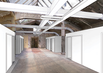
 Point cloud with dry wall installations, clash detection, Autodesk Revit
The FARO Focus laser scanner produces three-dimensional, coloured and geometrically accurate images that look like cloudy 3D photographs, so-called point clouds. To do this, it uses a laser beam to measure one million points per second
Many people interested in laser technology wonder what 3D scanning looks like in practice and how long it takes to capture a specific object such as a building or a factory floor and how much effort it takes to evaluate the data.
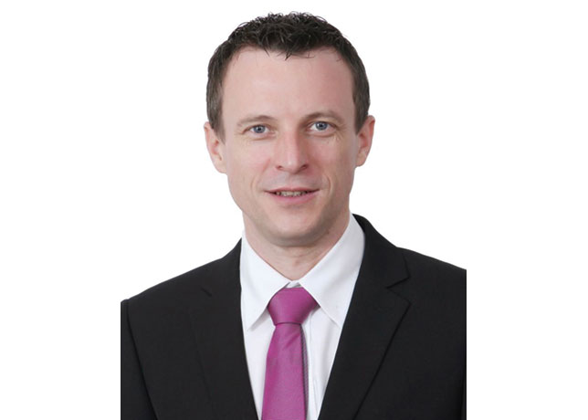
In this interview, Dirk Fichtmüller, Sales Engineer from FARO explains the workflow from the initial scan preparation to the production of deliverables using the example of a 1,200 square metre hall in the attic of a factory.
Excerpts:
How long did it take to scan the hall, for example to create a 2D floor plan?
I did the scanning alone and it took me about two hours. It is easy to extract 2D floor plans from the scans with FARO As-Built for AutoCAD Software. In this case I went through the floor with a FARO ScanPlan 2D Mapper before scanning in 3D. I had the floor plan after about 15 minutes, including nine 3D panoramic photos.
Those who don’t know the technique often think, you place the laser and everything is measured. Why did you need more than two hours?
The FARO Focus laser scanner produces three-dimensional, coloured and geometrically accurate images that look like cloudy 3D photographs, so-called point clouds. To do this, it uses a laser beam to measure one million points per second, about others the distance and relative position of the points to his own location. The device turns around his axis and scans ceilings, walls, floors, in short everything that is visible from his position. But it does not record what is not visible from its location, such as the sides and rear sides of columns, window reveals and lintels, or the room and the walls behind corners.
To capture these objects, you must change the scanners location. At the factory floor I needed 24 scanner positions, each scan took a little more than 4 minutes, then I had to move the scanner. Two hours is very little time for what the scanner captures. It captures everything in the room, pillars, windows, lintels, pipes, the roof slopes that could only be reached conventionally with a scaffold, but also unevenness in the floor, holes in the wall and in the plaster, things that could only be captured with tape measures in weeks of work or even not at all.
Dirk Fichtmueller at work
But after the two hours you have a finished 3D image of the hall?

With FARO scanner and software – yes. With scanners from other companies, hours of work still must be done in the office, especially for a target-based registration. Unfortunately, registration is a necessary, time-consuming and computationally intensive process that can take hours depending on the project size and number of scans. FARO does this on site parallel to the actual scanning process.
"Registration" and "target based", what do these terms mean and how can FARO solutions help to perform them on site?
The scanner measures the points relative to its own location. After scanning, there are a lot of single point clouds with e.g. two sides of columns and "holes" at the places that the scanner couldn’t reach from his actual position. These single scans must be assembled to one project to get an overall view of the object. It’s like mounting single photos to a panoramic photograph. At the end I want to see the whole hall in 3D, I want to measure the total length and width and do not want to work in a puzzle of single scans. This alignment of the scans against each other is called registering.
But the registration process is not easy. The scans must overlap, they must contain same objects from different views. But the single measuring points of the two scans on e.g. on a wall never lie at the same places. So, you can’t just bring points to coincidence.
Therefore, one pushes the point clouds into each other until most of the points on overlapping objects are as close as possible to each other. Optically you would say until it looks sharp. This method, "Cloud to Cloud" registration, has principally an inaccuracy of several millimeters. In projects with many scans the error can add up to centimetres.
And this is where the targets come in?
Yes. The targets are very precisely worked balls. To register two scans the software must find at least the same three balls in both scans. It knows that they are perfect balls, knows their precise position because there are many measuring points on the balls, and knows their exact center point. So, in both scans the positions of the same three points are known. The point clouds can be tilted and moved until the three points coincide.
And FARO does that on site?
Yes, that is the so-called on-site registration. The FARO scanner sends the data to a notebook while scanning. FARO SCENE software performs the complete registration parallel to the scanning process, cloud to cloud or target based.
The advantage is not only the time saved in the office. Much more important, especially for inexperienced users, is that when you scan, you can see the current state of the entire 3D project on site. You immediately see when important parts of the object have not been captured. It happens quite often that missing parts in scans were noticed in the office and the surveyor had to travel back to the object again. By the way, you can upload the registered project to FARO SCENE WebShare Cloud from on-site, so that interested parties can view the project already before you are back in the office.
And with that the job is done!
Yes. If the deliverable of the job has to be the point cloud. This is often the case when you have the task of documenting an object exactly. If surveyors have to deliver point clouds to clients, who want to monitor objects or to visualise them e. g. in heritage. In other cases, the work is just beginning.
What do you mean by that? Which cases are these?
The factory building we were scanning, for example, is to be renovated and rebuilt. The pure scan project is now used in the search for a project partner, interested parties can view the factory floor on SCENE WebShare Cloud (link at the end of the article). As soon as a partner is found, the rebuilding and renovation planning will begin, perhaps in AutoCAD Software, very probably in Autodesk Revit. FARO offers industry-specific workflows, from scanning to data evaluation in AutoCAD and Revit. Specialised workflows for many AEC industries. FARO also offers programs that use 3D scanner data for object monitoring, quality control and design layout.
Why do you still need evaluations? Isn’t all the necessary information in the point clouds or in the project?
The point clouds consist of millions of single points. Planners use CAD and BIM programs. For them, not coordinates of individual points are interesting, but the fact that millions of individual points form a wall or a complicated piping system. They should be available as BIM objects in Revit, or as a pipe-run in AutoCAD Plant 3D, so that you can continue working with these objects in their planning tools. They want to know whether planned objects collide with existing ones, whether scanned surfaces are flat, how large tank volumes are, how far real objects deviate from planned ones. For this information they need evaluations and FARO has the appropriate software, like FARO As-Built for AutoCAD Software and FARO As-Built for Autodesk Revit. With these plugin solutions, point clouds can be evaluated quickly and easily where they are needed, i.e. directly in AutoCAD and Revit.
You emphasise this as if it were more important than scanning?
The entire workflow is very important. The software is often neglected when deciding which systems to choose. One hour of on-site scanning is followed by days of evaluation in the office. Exact values cannot be given, it depends, for example, on the degree of detail with which I want to evaluate the point clouds. Are scanned pillars enough for me as simple cuboids or do I also need the beveled edges of the pillars? But to be clear, the choice of the right workflow decides whether I can deliver my BIM model after one or three days or after 3 weeks.